actually I need to know the first step of running it. if I need to import any files for it ? or if there is some special site to get gis data please inform me
“Unfortunately, the ESRI geocoding service recently switched its endpoint from “http” to “https”, so the one that’s embedded in the component will no longer get results. This is the case for a few of the other components as well. I am, however, actively developing updates to Heron on Github (GitHub - blueherongis/Heron: An add-on for Grasshopper enabling the GIS functions of GDAL in Rhino 3d) and making them available via the Yak Package Manager and this issue has been addressed with Heron 0.3.2. If you aren’t familiar with the package manager, you can access it by typing “TestPackageManager” in the command line for Rhino 6 and “PackageManager” for Rhino 7. Once the dialogue pops up, you can search for “heron” and install directly from there (no need to go to Food4Rhino). Before doing so, I would delete all existing Heron files from the Grasshopper Libraries folder to avoid any conflicts. Once you have the latest version of Heron installed, you will find you will need to replace the Heron 0.2.0 components with new ones. Also note that there’s a lot more functionality with the new version, but I have yet to document it, so if you need any help understanding how things are working, please let me know.”
Here are my WIP script with the new components, but unfortunately I can’t get it to work properly… going to work on it today. If someone knows how I can get the streets to show like lines, please let me know! Heron_Example_ halfway working.gh (92.4 KB)
If you are looking to show roads from the US Census Vectors source, try adding the Secondary and Local roads to the query. The Primary roads are highways and may not show up if your boundary curve is too small and does not intersect the highway.
Hallo, so a little update on my side. I made it work but, now I have some trouble with getting the satellite image when I move the boundary. It gives me an Error massages and somehow it doesn’t want to work with my own location?
Thank you so much for the answers! I have yet more questions, and sorry for having so much, but I guess it would be useful for others as well.
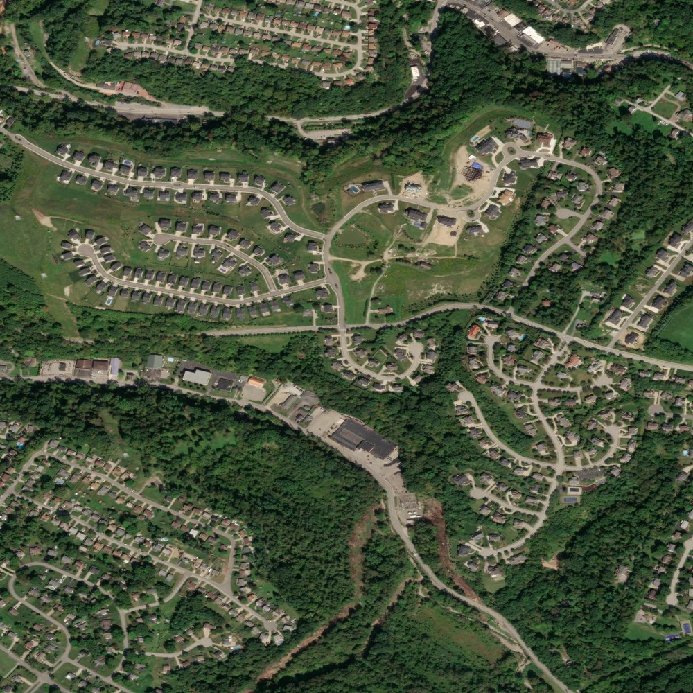
How can I export the image that is cropped by the boundary curve? The saved image is starched and bigger, but I want to have exactly the square that I sued to map the image with Heron onto that is 1 km. x 1 km or how can I bake/ print the picture in rhino? . I hope you understand my explanation.
The image form the folder :
Happy to answer any questions about Heron! I usually use the Human components to surface map my boundary (turning the boundary into a mesh in the process) and bake it into Rhino. From there, I print to PDF. The image sampler is not the best tool for color manipulation, so you might look into alternates like Bitmap Plus.