Hello, i don’t know if my topic is in the right category.
I create this tool because i need it for a project, i tried some old addons in Grasshopper but didn’t work, sometimes api needed or the servers are not available.
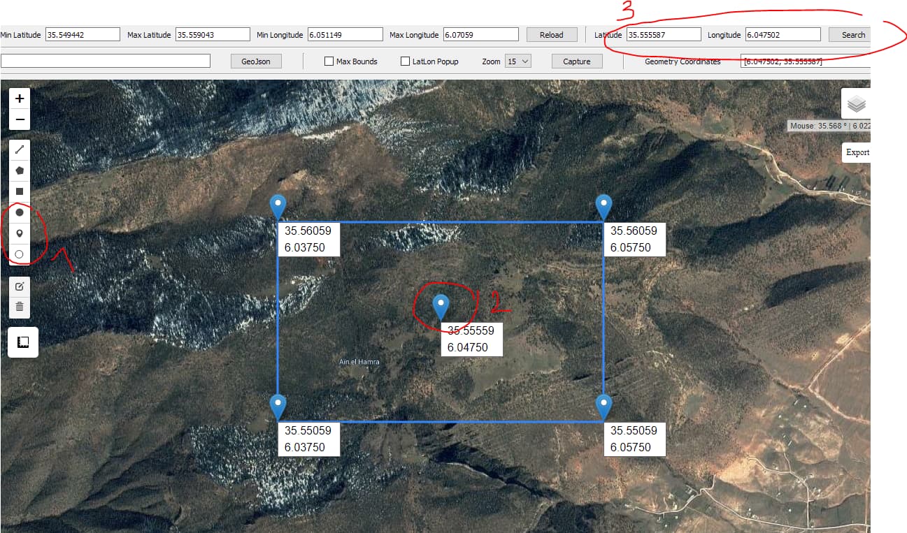
-With this tool we can choose a region between two coordinates points : min and max, or use one coordinates point of known place , the tool create a rectangle with markers and their coordinates.
-We can load many geojson files like roads, buildings …
-Max bounds if it is checked fix the position of the region.
-LatLon popup if it is checked allow to view point coordinates when click in the map.
-Capture button to capture the map in full screen mode and save it as png.
-We can draw shapes like buildings and roads and Export them as geojson file , than we can view the file in JOSM or other softwares.
-When we draw a shape and click on it the coordinates of all points appears in Geometry coordinates and automatically copied , we can paste it in an empty text document.
I hope you find it useful
GeoJson

Export blue line

Created with Python 3.7
Modules needed to run the script:
- -folium : folium · PyPI
- -selenium : selenium · PyPI
- -selenium need : chromedriver.exe
- -clipboard : clipboard · PyPI
- -json
- -PyQt5
- -functools
map.zip (6.6 KB)