I’ve used Rhino to preview shadows (rendered display mode) and they don’t match exactly with some other software such as Revit
I’ve input the exact same Longitude and Latitude referencing the same point in model, and time with correct daylight saving. Same true north.
Model is exported directly from one to the other. Anybody ran into this before?
How does either one match up with what you see out your window - assuming you can model a few objects that exist outside your window to use for the comparison?
difference between Rhino and Revit sun shadows is very small
I could try that to verify but I’m not sure how accurate I can get a true north in real life.
Well, we are designing and building prefabricated exterior solar shading systems. Don’t think that 2-3 degree do matter for our purposes. Nevertheless it would be interesting to see which software delivers better results, while I’m not really expecting to get 100% correct results from a shaded mode. There might be possibilities in grasshopper to generate exact shadows.
I’ve tried that. GH is consistent with native rendered view. Still slightly off from Revit. We’ve got some fussy client people who think that few degrees are big deal…
I’m surprised. My guess would be that if you are interested in shadows to a high degree of accuracy you must be in architecture or a closely related field. That would imply to me that you must have a working relationship with some surveyors who could probably give you true north with +/- 1 degree or better from any spot you pick.
At any rate, before you get into Rhino/Revit argument with a client I’d think you’d want to establish a method to determine which one is closer to reality. And I agree with Joerg.H that 2-3 degrees difference, even from reality, just doesn’t make any practical difference.
And either way, whichever one is found to be the more accurate, I’m sure the other guy would appreciate the info so they can tune up their software.
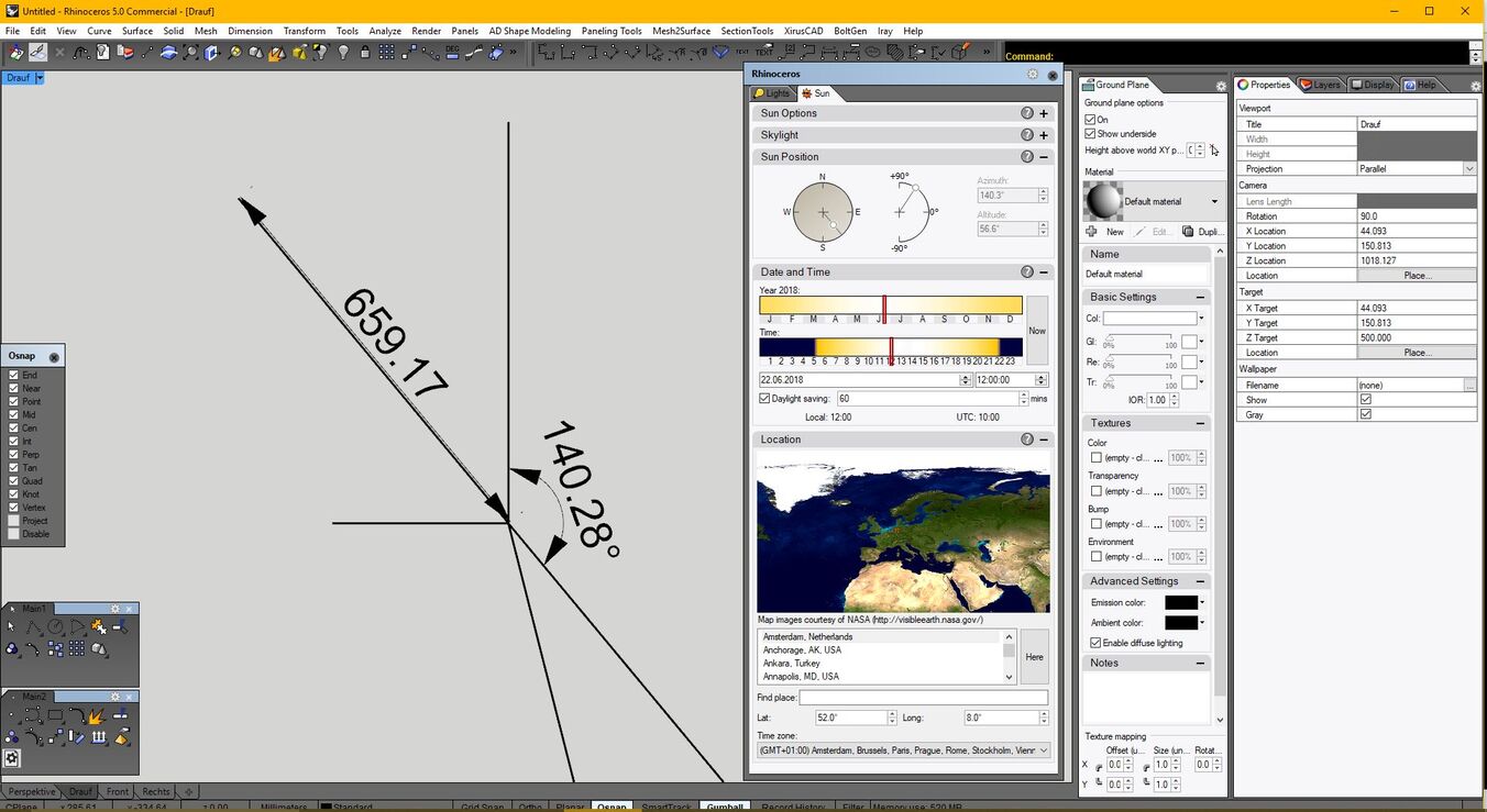
I´ve made a small test. A pole with 1mm Diameter, 1000 mm long. A place in my area, map datum WGS84.
Rhino rendered mode seems to be absolutely correct with these coordinates.
Can you reproduce this in Revit? What is your problem with true north direction?
Now that Jorg’s study has kicked my mind into proper operation, I remembered that on a sunny day all it takes is a vertical pole and a ruler to find true north at your exact location. Just measure the pole’s shadow length every 3 minutes or so for 30 minutes before and after local noon. If you adjust for how far west you are from the eastern border of your time zone you can estimate approximately when your local noon will be on your time zone’s clock and then you can cut your measurement period down accordingly. You’d probably still want 10-12 minutes either side of local noon so you get a definite minimum. When the shadow is the shortest it’s pointing to true north.
Thanks Jorg!
My hunch was to trust Rhino but I couldn’t find a way to verify other than conducting a real life sun dial experiment, which may very well be affected by my own human errors.
I was hoping someone from McNeel would tell me how they created the sun tool and why it is reliable so I can explain to my colleagues.
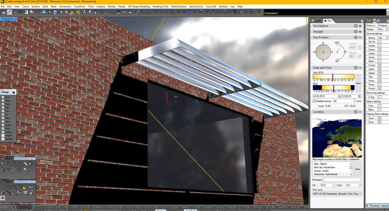
I still don´t get your problem. If Revit gives different values than Rhino, what has this to do with true north? Is true north geometric north for you, and you have measured something with a compass that measures magnetic north? Than you will have a magnetic declination of some degrees. In our waters ( german bight) this is only about 1°. Depending on your location this can be much more. Have a look on a seamap, if you are close to some waters. The value changes slightly every year, but this is also indicated on the maps. Attached a more real world simulation…
true north isn’t a problem.
I was just saying I wanted to know where my true north is in real life so I can take the angle between a flag pole shadow and it. This way i can cross check either software with real life scenario. I don’t have a compass at hand either…