Beginner’s luck running out…
My goal: to scale up the Google maps coordinates I have created from an Excel spreadsheet into Rhino so they match to a DWG imported from DigiMaps UK. Both sited at location: Dundee, Scotland.
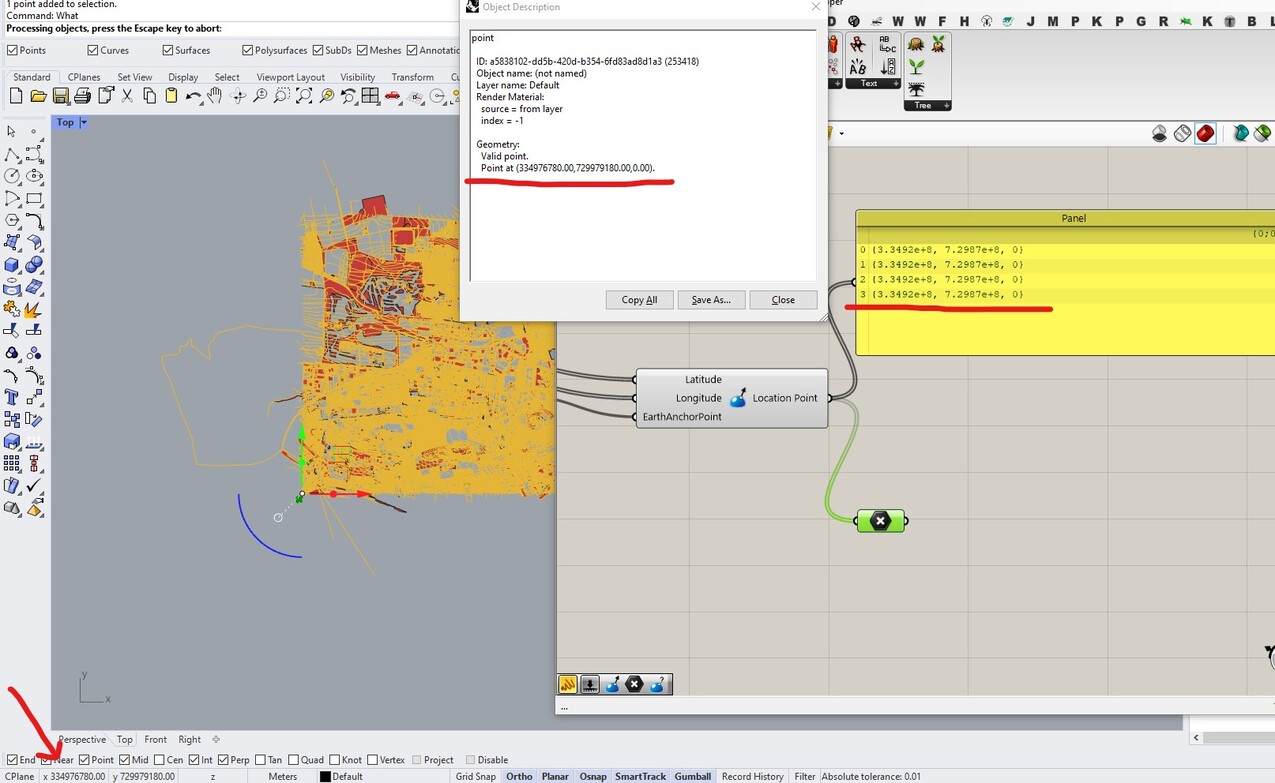
I had set the Earth Anchor Point but even after Lat-Lon to XYZ conversion, the Excel points are still way off. (ref: screenshot)
I have searched around and found some similar posts, this one by Andrew Heumann seems promising but I am assuming that he means use C# node – I am just not sure how to implement it in GH.
I think Vec2Pt could be a way of moving the Excel Points?
Can anyone help me or just point me and my data in the right direction? 
My .gh file relies on Heron plugin.
maptest3.gh (1.6 MB)
Hello
you need to know which projection was used for DIGIMaps UK. It seems to be a projection in km or miles. A tool like QGIS will be able to do whatever transformation you want.
If your data is like Lidar it must use
British National Grid projection
see that
https://digimap.edina.ac.uk/webhelp/lidar/faqs/faqs.htm#MiniTOCBookMark4
It seems the equations are there
https://www.movable-type.co.uk/scripts/latlong-os-gridref.html
Cheers! Earthworm helped, and QGis got the dwg on the correct coordinates!
But it is still not quite there.
I think I need to scale the point values. I would guess this is because one is in mm and the others are in m or km.
Either way thank you for your suggestions!
maptest4.gh (9.1 MB)
If you are using the latest Heron from the package manager, you can use the the new Coordinate Transformation component to get the Lat/Lon from Google (EPSG:4326) to the British National Grid (EPSG:27700) - thanks for the pointer @laurent_delrieu! Note that the Longitudinal value needs to be a negative number for this location when setting the EAP. I also noticed your original geometry seems to be in kilometers, so the output of the Coordinate Transformation needs to be scaled from meters to kilometers in order to overlay correctly. I’ve added a satellite underlay using the same coordinate transformations to get it matched up from the Slippy Raster component.
maptest3_BW.gh (1.7 MB)
If you are interested in bringing Lidar data in from Digimaps, you could use the new ImportLAZ component in conjunction with the Coordinate Transformation component as needed.
1 Like
I don’t know if this help
@Brian_Washburn thank you so much this worked. I had a workaround with OSM but this works so much better. I love the Slippy Raster too!