I have two mesh surfaces and I want to display color map of the distances between the two surfaces (red to blue).
Any suggestion to do so in grasshopper?
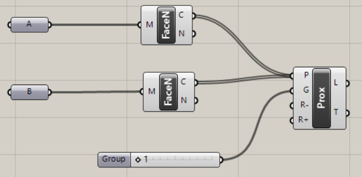
I tried to use Proximity 3D, but it results in all connected lines displayed.
But I am stuck on the following questions.
How I can make these proximity (distances) as color map on to one surface?
How to find the closest point to be displayed as a point on the surface?
How to increase or decrease the density of the points on each surface (mesh)?
It worked as I wanted exactly. One more add-on. How to show the gradient legends (color and value)? I want to place the bar legend right next to the mesh. Possibly, also, capture the view (perpendicular view) and save as an image file as well (tiff or jpg).
I just noticed that the closest point location, distance value, and the point representation as a small sphere are not in your solution.
Could you add this feature as well in your gh file?
great solution. Thanks, Kim. I want to add a feature that visually show the location that has the closest as a small sphere on the 3D coordinates and the distance. I looked up, but it is difficult for me to figure out how to find the coordinates and the distance value in order to create a sphere on that coordinates with the text of distance value.
Would you be able to help on this as well?
Wow… you know sometimes it can be so hard for a novice user to figure out a single button or function. I guess you don’t understand this kind of difficulty, maybe because you are such a genius and knows everything from the beginning.
Yes. I have spent about an hour to find out the stupid “text dot” component and still cannot find it in my grasshopper. At least it does not exist in my version of grasshopper, or I am not ‘intelligent’ enough to find it. If you don’t want to share your great knowledge to other people who want to learn, then it is fine, but please don’t just show off.
Hey, dude…
I think @laurent_delrieu already provided almost everything you need. There may be components you can’t find. Sometimes it is a plugin, not a native GH component. https://rhino.github.io/components/fabtools/textDot.html
In that case, you can browse the plugin or replace it with something else.
And before you start asking the next question, please read bellow first and upload the file you are working on.
Hello
I understand your frustration, my fault for text dot.
I learned by myself grasshopper trying to resolve problems. What I learn is that I learn by doing, searching, exploring. using google is also a good way of finding solutions images …
Good luck.
Thank you for both Laurent and Kim, I looked and tried Tag, label, etc
before I asked. There are plethora of materials and tutorials. I also watch
and look for Youtube and Vimeo channels It takes long time to learn new
stuff. Your help substantially accelerated my learning time of grasshopper.
Thank you again.
thanks a lot to everyone contributed here. I`m also a bit of a newbie to GH or learning slowly. Have done quite a bit in GH. But it’s not really easy to understand often and I haven’t done anything in GH for at least a year. Hope someone can help.
I’ve used the script above to investigate to distance between to hull surfaces. I need to create a volume from the final hull und have to merge two hulls into one. Above the Waterplane is another one of which I need to keep the upper edge and the Stern characteristics. This is already quite ok.
The hull below the waterline is quite a bit more complicated and I have tried with updating sections. But as Rhino doesn’t offer a tool to measure the distances as you’re going, so “live”, I’ve been looking for a solution and got quite close.
What I would like to add (have added ) is following:
Positive and negative numbers, so it’s clear what’s inside the target surface and what’s outside. This way it would be easier to see, if a point has to move out or another one in.
To have the gradient scale always on screen, no matter what view or part of the hull I’m viewing ( So I don’t need to turrn the model anytime to check the changed scale)
Most important it seems, I didn’t manage to move the sphere to most diverting point between the surfaces. The sphere moves, but it’s not at the darkest red area.
For NDA reasons I needed to scale my hull and delete most of the surfaces possible. So in reality I’m down to 170 mm difference and there are a few red spots.
I have been looking a very long time, years…, for a tool like this. This forum is for sure the best I have seen.
I’d like to learn, how it works. So if you could explain the mistake with the sphere or the options to add above, I’d be really grateful. A lot better than having a finished definiton to download here.



 ) is following: