Hello,
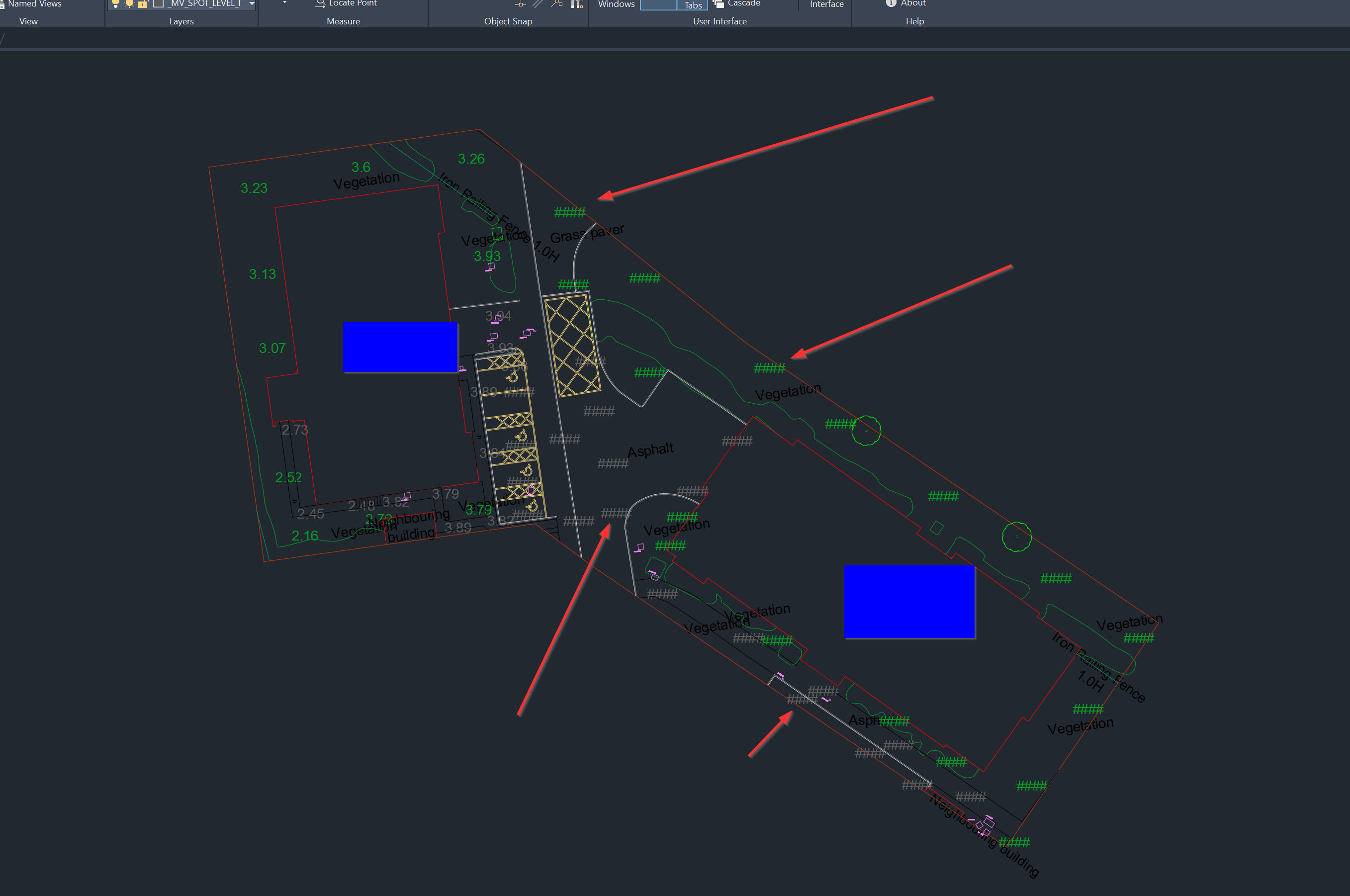
I created a block like you suggested, and it works fine, but only in Rhino. When I export files as dwg the heights are converted to ####.
Is it possible to export the real values? The numbers on the left side of the image are normal texts.
Hi @s.urbanski.
I haven’t tested dwg exports with these blocks myself.
You could try exploding spot elevation blocks before exporting but this may cause the blocks to revert to the internal string or ####.
Perhaps @wim can advise…?
Hello @hughecchapman
Thank you for your suggestion. Indeed, exploding the block allows to export the values and see them in Autocad.
What worries me is that is a rather drastic way. Afterall, you can’t revert exploing blocks later.
I wonder if there is possibility to keep the blocks and export the correct values.
One option would be to copy all the spot elevation/ spot coordinate blocks you want in your DWG export (e.g. by having them all on a layer and then duplicating this layer) and then explode the copied blocks while leaving your original dynamic blocks intact